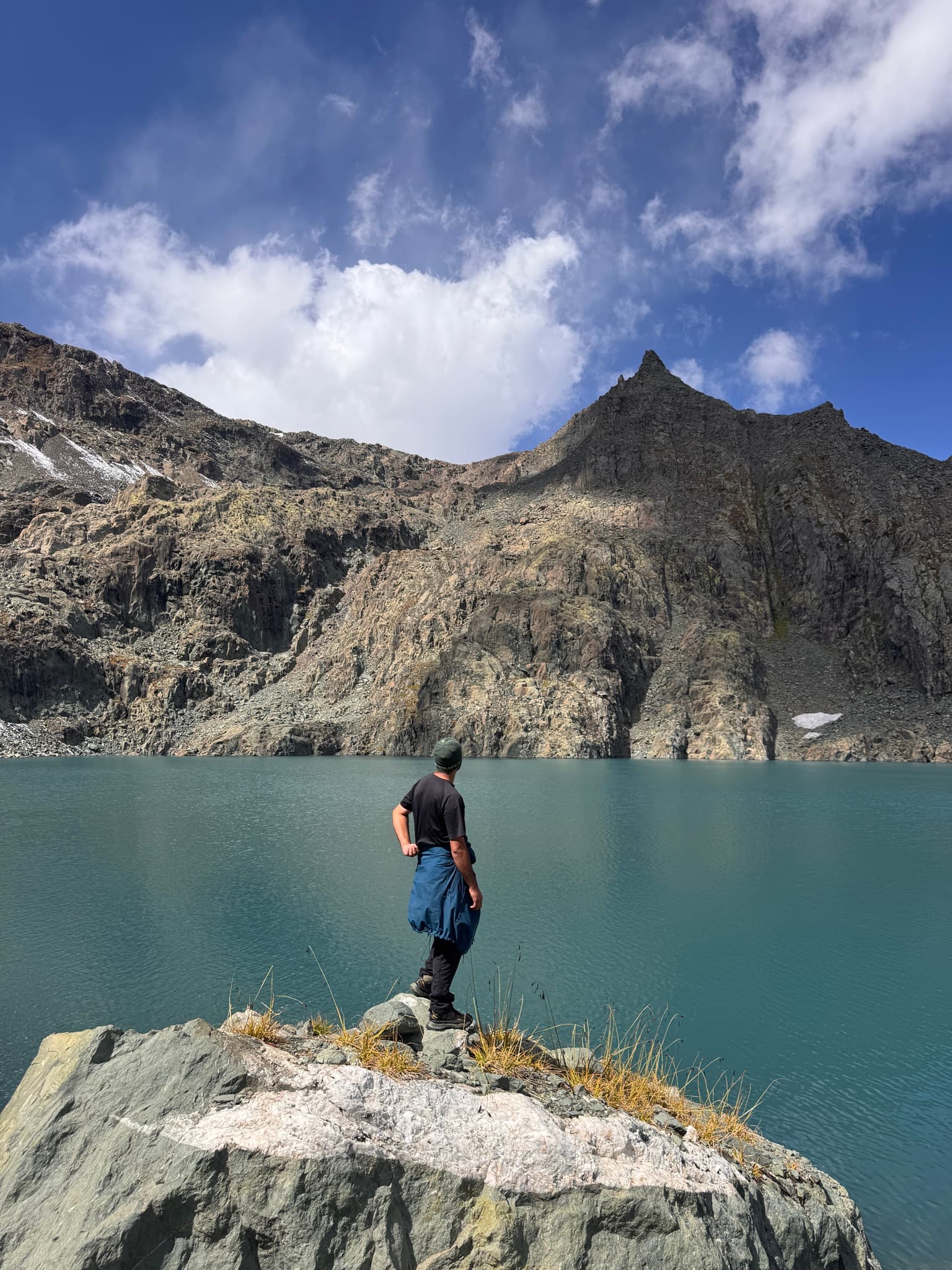
 Photo · Shahid Shabir
Durinar Lake Trek
Sarbal village · Ganderbal · Central Kashmir- 17.4 km
- Distance
- 2–3 days
- Duration
- 4,591 m
- Highest
Important to know
Route
Out and back. The walk finishes where it started, and you come home along the trail you walked out on.
- Way out
- Shared · both ways
Along the route
Day 1
Sarbal villageStartkm 0.0 · 2,816 m- Durinar ICheckpointkm 6.3 · 4,175 mFirst of the three lakes, reached after the long climb out of the Sarbal nallah.
Day 2
Durinar II (Nilnag)Checkpointkm 7.1 · 4,277 mSecond of the three lakes, also called Nilnag or the Sapphire Lake, lying in the flat basin the route crosses at about 4,275 m.- Durinar III (Barafsar Lake)Destination · Turn back herekm 8.7 · 4,585 mHighest of the three lakes and the turnaround point, also called Barafsar, the Ice Lake, at the head of the basin. Widely described as the highest alpine lake in the Kashmir valley; ice and old snow often sit on the shore well into the season. The climb up from Durinar II is the steepest and loosest ground on the trek, and the view from the rim takes in Zoji La, Kolahoi, Harmukh and the Thajwas peaks.
Distances are measured along the track from the road head.
Photographs
Walked it? Add up to 6 photos at a time from the app. Approved photos show in the gallery with your name.
Gear checklist
clothing
gear
safety
medical
0 of 14 packed
About this trek
Season window
The basin holds snow late, so June and September are walkable rather than good. July and August are the dependable window; even then, old snow often sits on the shore of Durinar III, the highest of the three lakes.
Getting there
About 56 km from Srinagar as the crow flies — the road is longer.
Directions to the trailheadTrekker reports
No trekker reports yet. Conditions on this route change week to week — if you walk it, a short report on pass snow and river levels helps the next group. Reports are posted from the Kashmir Explorer app.